
Big Hike
October 24, 2021
Hello everyone,
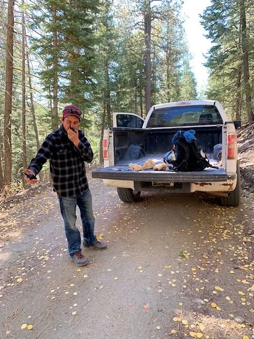
I have a special edition of the good, ol' weekly letter back home this week. My friend, Valentin, and I finally did our big hike from Barillas Peak back down to San Jose and, boy, was it awesome! We've been planning this for some time and even had to cancel it last-minute after Valentin was up half the night one Friday night for an impromptu party with family and friends a few weeks ago. This time, however, we locked our plans into place and had his Dad drive us up almost to the summit of Barillas Peak, where the fire tower is, so that we could depart from as near the tower as possible(it's a restricted space because it's still operational). We pulled the pickup off to the side of the forestry road, directly to the west of the fire tower with a clear view of it, and unpacked our gear quickly, waited for his dog, Loka, to hop down and stuffed some snacks in our mouths and started walking. The summit of Barillas Peak is 9331' and we were about 600' below that at around 8700'. We followed the forestry road south for just a few hundred yards until it bent back over the mountain to the west and we had a great view to the south where we could see our distant target of Rowe Mesa, which has San Jose comfortably situated on the Pecos River just below it. Having checked our maps we knew that the distance between where we live on the ranch and the peak was about 11 miles or so as the crow flies. We also knew that we would have to meander a bit, no matter how straight we could keep our course. We both decided to bushwhack as much as we could and to try and avoid any unnecessary bends, circles and tangents. In the end, I came up with an estimation of our walk ending up being about 15 miles and, sure enough, with the help of a hiking app on this stupid smart phone that I now carry we ended up clocking in at 14.9 miles, covered in six hours. Not too bad, but, boy, were we feeling it for the last five miles or so!
The ranch that we live on lies on the Rito, which is a feeder stream to the Pecos River and it dumps into it just upstream from where my friend and his Dad live. We were trying to find the headwaters of the Rito and then follow it all the way down. Now, saying headwaters implies that there was a little bit of water running at the bottom of these canyons, but that was not the case. We only saw very intermittent pools of water that always seemed to be a good half-mile or mile apart from each other, but most of the way down was bone-dry. In the end, after studying some more maps once I was back at home, I found that we went right off the nose of Barillas Peak, which led us down onto Barillas Creek, then Commissary Creek, before it joined the Rito much further to the south. Had we followed Valentin's Dad in his pickup back down the road and over the mountain to the west, that next ravine was none other than the Rito. I would say that the first half of the trip(half the mileage and about 2000' of the 2500' drop in elevation) was pure bushwhacking, nothing more and nothing less. We both had sneakers on and kept turning our ankles as we were trying to walk a little above the canyon floors that were filled with brush oak, and after we got below a certain elevation, multi-flora rose. After an hour we had covered two miles and stopped to eat, as it was noon, and feasted on homemade soft pretzels that Erin had made for us, as well as salsichon and cheese sandwiches that Valentin made, plus loads of other Mexican delights that were either really sweet, really hot, or both! The second half of the trip found us stumbling onto some old woods roads that were much easier to walk on and, as we had only about 500 more feet to drop in elevation, we had much less pounding and braking on our legs and we started making better time. The down side of it all, though, was that we were already quite tired and as we walked the last five miles on gravel roads through our ranch, our legs were all but jelly and we ended up calling Erin to have her come grab us to save us from the last couple of miles and from picking which of our houses to end at.
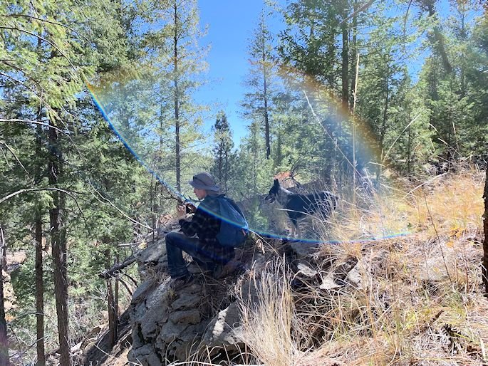
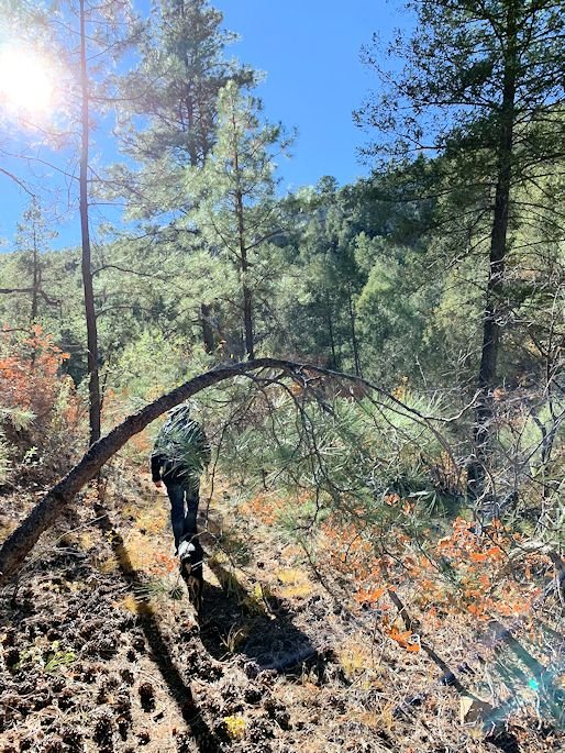
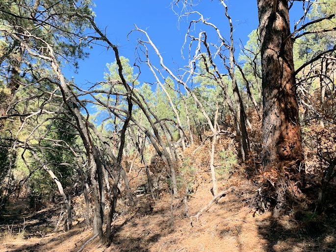
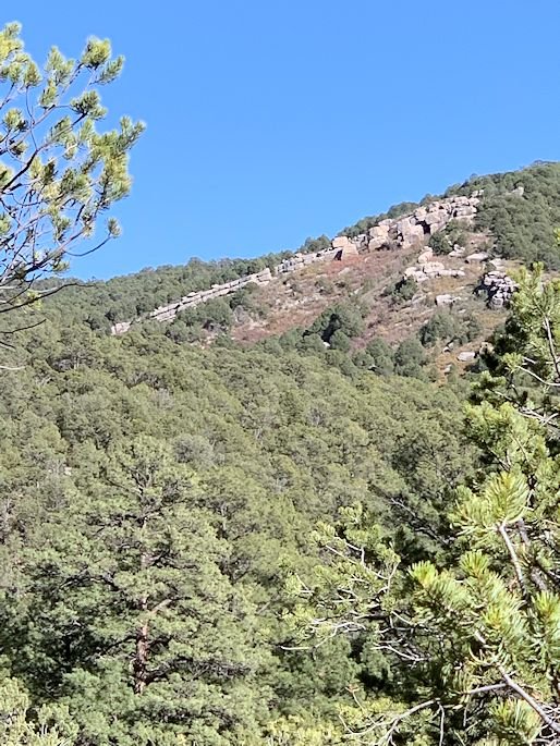
Now, a big batch of pictures from our long walk home! Today is just pictures from the first half of the hike when we were still up high in the mountains and hadn't made it out of the national forest yet. So, first, a shot of Valentin testing his walkie-talkie with his Dad before we got packs on and started. Then, a shot of the fire tower just above us. Next, our jumping off point from where we could see all the way down to Rowe Mesa in the distance. Then, a shot of Valentin and Loka as we plunged down into the canyon. Then, a shot of what a lot of the creek bottoms looked like: no water, but patches of green grass. Next, a shot of some of the goodies that we had for lunch. Then, the first old woods road that we came across...unfortunately, it didn't last long and disappeared on us again after a short distance. The next two shots are some of the clearings and meadows that we walked through after we left the road again and the trail narrowed to a foot path, the first one with Loka posing for the camera. The next two shots are from the steeper parts of the canyon that we eventually got into, first, with Valentin checking out the other side and, then, the other side itself. Then, another little bit of road that we found that afforded us another view of the mesa to the south. Next, a shot of a little, rocky ledge high up above us to the west with the quarter moon setting above it. Then, a shot that I took of myself as we were approaching the halfway point. Next, two shots of the canyon floor, first, a rocky chute that looks to quite often have water coursing through it after storms or snow melt, then, a shot of Loka taking a big drink. The next three shots are from a really pretty stretch that we went through: first, a wild cave that we saw across the way; then, a great shot that just presented itself to me; and, finally, with it being October, a patch of trees that we felt looked especially Halloween-like. Then, a huge rock shelter that we found, with a shot of it from across the stream and, then, a shot from inside that shows how sooty the ceiling of it is from many ancient fires...had we not been in the middle of a huge, long hike, we both would have gladly spent the rest of the day there rummaging around. And, finally, the last three shots of the first leg of the journey: some crazy stacks of rocks, posing as cliffs, high above us; then, a huge, ancient pine that I could in no way fit into the entire shot; and, lastly, a view back up into the higher mountains that revealed a huge wall of boulders that looked like some giant had stacked them all up just so...one of the many, amazing things that we saw that day! Next week, part two of the trip as we got down lower in elevation and had old farm and ranch roads to speed us along to the finish line!
Take care.
Load Out

Fire Tower

Our Distant Goal
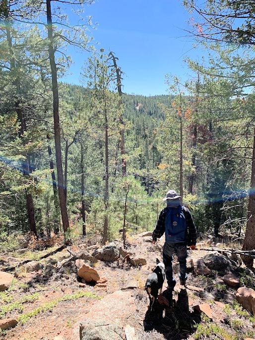
Hiking Buddies

Grassy Bottom
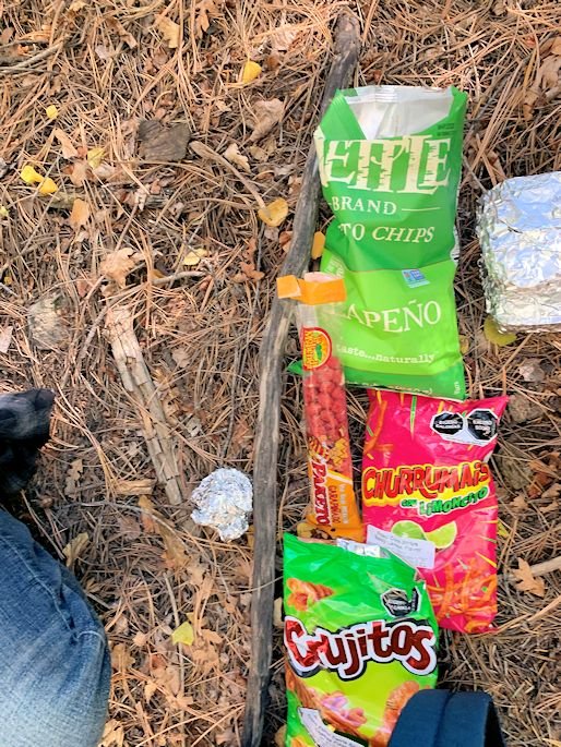
Snack Break
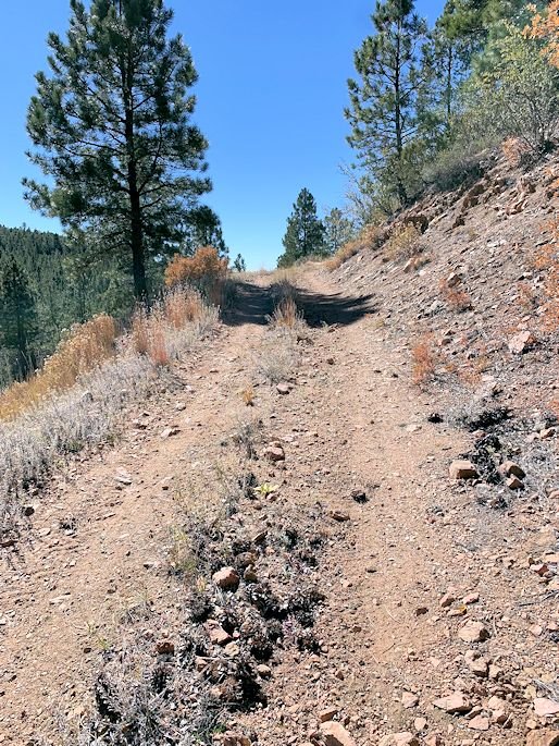
An Easier Way
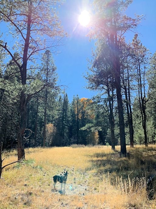
Loka en la Vega
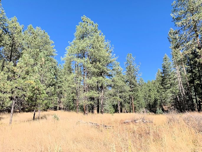
Grassy Meadow
Clifftop View
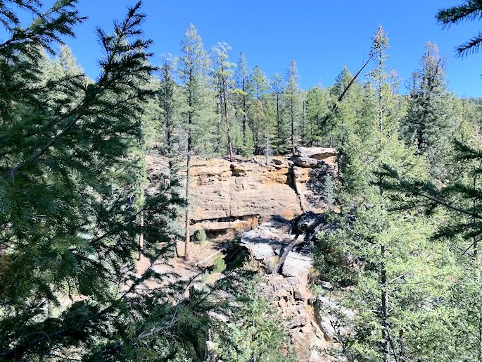
Opposing Cliffs
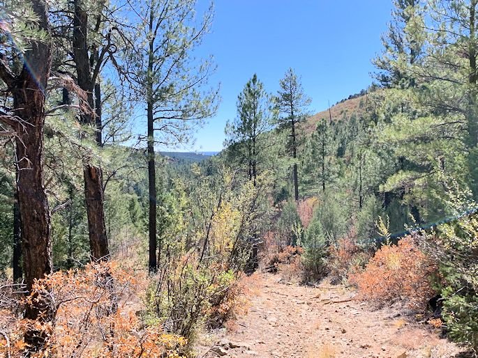
A Glimpse of the Finish Line
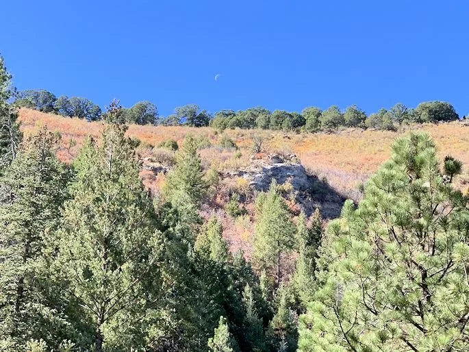
Moon Cliff
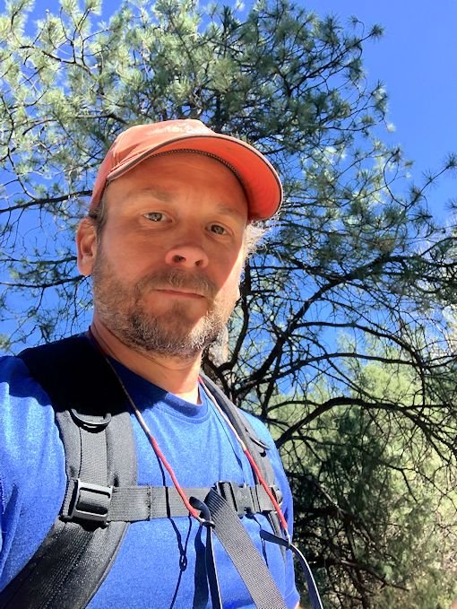
Mid-Walk Self-Portrait
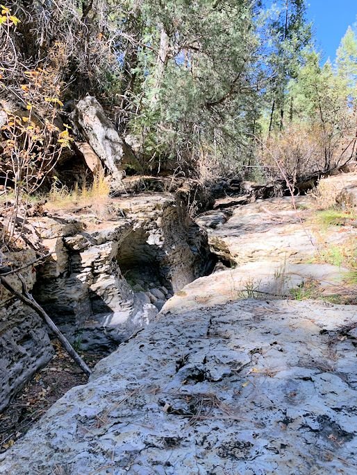
Rock Chute
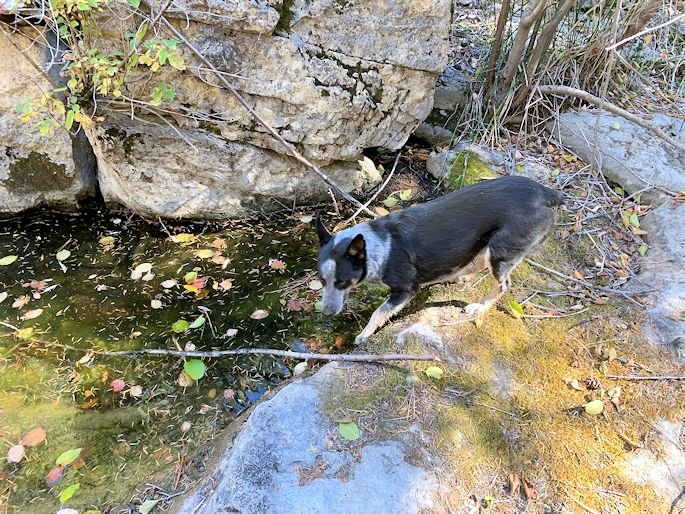
Drink Break
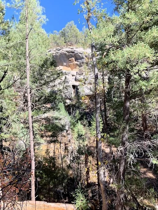
Wild Cave
The Arc of Time
Halloween Trees
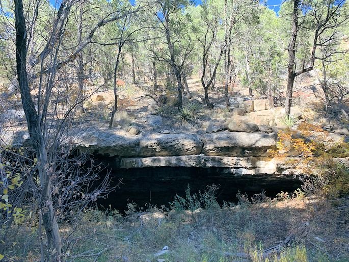
Natural Rock Shelter
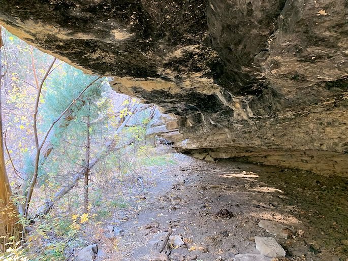
Sooty Ceiling
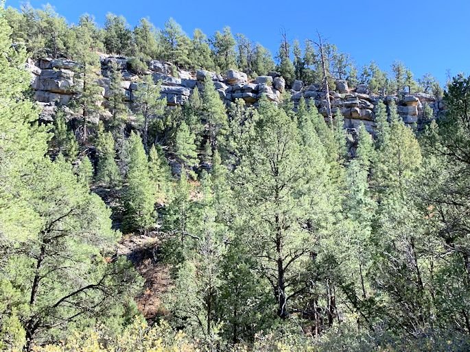
Stone Stacks
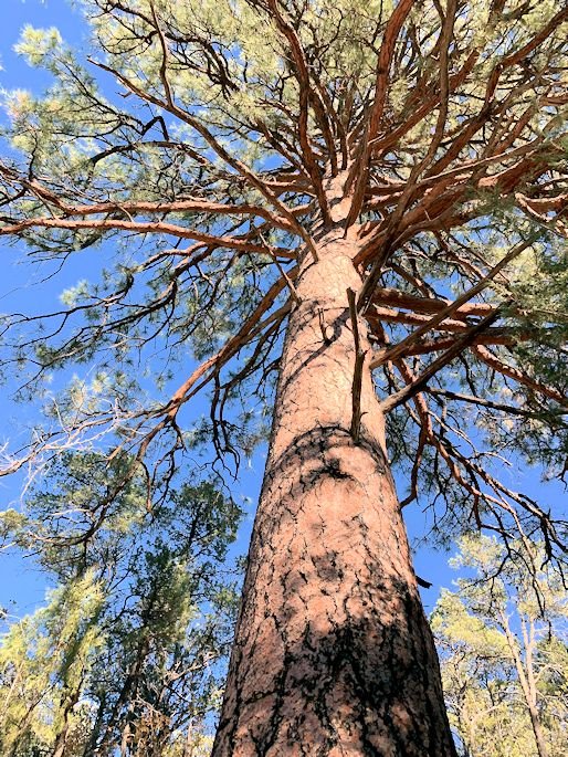
Ancient Pine
Giant's Castle