
El Morro
March 3, 2024
Howdy folks,
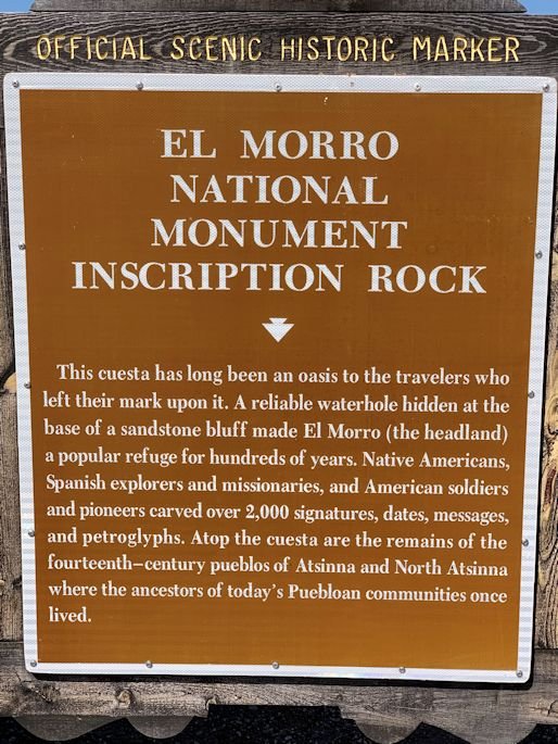
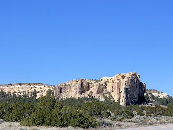
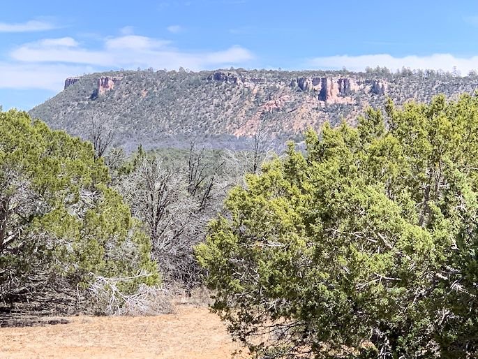
My, oh my, did we take a wonderful trip this weekend. A month or so back I mentioned some of the destinations that were on our list this year to explore here in New Mexico and we just put the first notch in our belts! We went out to El Morro National Monument to see the iconic cliff that stands there over the land and also to check out the ancient Pueblo ruins up on top of it and the big pool at the bottom of it, with cliff walls completely covered in petroglyphs and graffiti. We drug our butts out of bed at six in the morning and got ourselves and the dogs in the car about a half-hour or so later. We hopped onto I-25 and zipped down to Albuquerque, about 75 minutes away, then got on I-40 and headed west towards Gallup and Arizona. A little over an hour later, we got off of the interstate in Grants and stopped at the El Malpais National Monument Visitor Center to take a bathroom break and to let the dogs out to do the same. El Malpais is absolutely amazing! It's 114,000 acres of preserved lava flows, lava tube cave systems, cinder cones, spatter cones and other volcanic features. Literally everywhere that you look around you, all you can see is basalt. So, we checked the gift shop and museum out for a little bit, but wanted to keep moving so as to get out to El Morro. Initially, we had plans of possibly going as far west as Zuni Pueblo and then back up to Gallup, so I wanted to keep a steady pace. In the end, we never made it any further than El Morro and then even doubled back so that we could do a super quick hike in El Malpais(Badlands in Spanish, by the way). So, we were still an hour away from El Morro, but now would be heading there off of the interstate on a smaller and quieter state highway. We slowly climbed all the way up to 8000', before settling back down a few hundred feet into the mid-sevens at our destination. Along the way we saw stands and stands of ponderosa pines, which apparently are able to grow really well in all of the basalt, as it is very porous and allows for the trees' roots to easily shoot down deeper and deeper into the water table. I've been reading about this part of the state forever and was literally chomping the bit to finally see it. And, once we got to El Morro, it did not let us down. Standing a few hundred feet, but looking like a few thousand, over the rather flat land all around nearby, the cliff slowly built itself up from one side to the other before plunging straight down at the other end, in a completely vertical manner. Jackpot! Before us stood ruins, petroglyphs, Conquistadors' messages and an oasis of water in the middle of nowhere out in the lonesome New Mexican high desert.
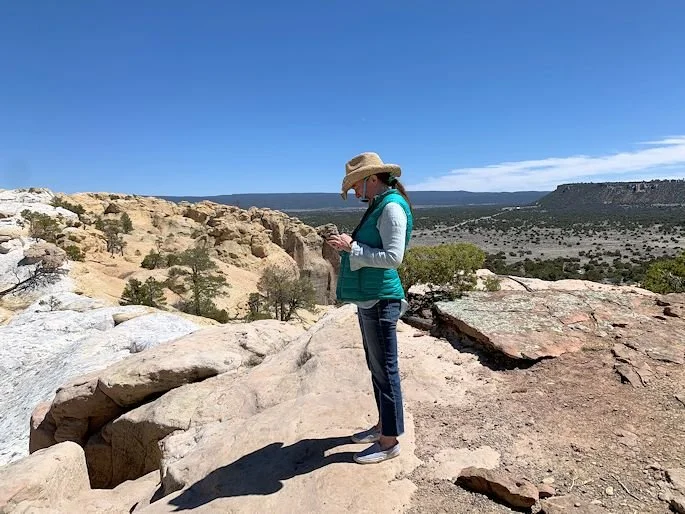
So, we pulled in and situated the dogs. They're bird dogs and like to runs miles at a time, so in situations like this, they just stay in the car until we can pull off somewhere out in national forest land to let them run around a bit. We went into the always-great national park museum and gift shop and quickly added to our vast collection of books. Then, depositing our catch back at the car, we hiked up to the top of the ridge to see the 14th century ruins of the village of Atsinna. This place was inhabited by the ancestors of the Zuni people, who are now residing a little further west on the Zuni reservation, by far the largest one in the state, on 700 square miles that borders Arizona. We were much further west than usual today! So, after that, we hiked back down to the bottom to check out the pool of water, first called El Estanque del Penyol (the pool of the big rock) by the first Spaniard to ever lay eyes on it. Native Americans knew about this place for centuries, if not millennia, as it never seems to run out of water. It's 12' deep and has 200,000 gallons of water...and it's not a spring! All of this water is run-off from the top of the cliffs whenever it rains or snows. How big of a deal this was cannot possibly be underscored. Water is everything, everywhere, but most especially so in the desert. And, to make this site even that much cooler, not only did it have ruins and a bottomless oasis, but from time immemorial right up to the present, people have been carving petroglyphs and other symbols into the base of the cliffs. Then, once Europeans began to arrive, starting with the Spanish, people began leaving their names chiseled into the rock, sometimes in an easy block form, but sometimes in a very intricate cursive. So, what a great day we had. To top it all off, we hiked down to a lava tube on the way home in El Malpais and then put the hammer down on the interstate to head home, with our minds and hearts filled with all kinds of dreams and possibilities.
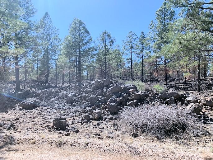
Now, picture time! First up, three shots at the entrance to the National Monument, two showing the sign and one just the cliffs. Then, four shots of Erin roaming around, checking everything out, in her signature East Coast/West Coast, flip-flop cowgirl style. Next, two shots of the views that just begged you to stare in their direction from the top of the cliffs. Then, a shot of Erin walking back to the visitor center once we got done seeing everything. Next, three shots from where we did our quick hike on the way home in the El Malpais National Monument, showing how ancient lava, now basalt, literally litters the ground as far as you can see in every direction. And, finally, three more shots from the ride home: first, seeing Mount Taylor right outside of Grants; then, approaching Albuquerque from the west; and, lastly, coming into Santa Fe from the south. I have tons more pictures and stories from our trip, so stay tuned in the weeks ahead as it may take three or four updates to share it all with everyone!
Take care.
El Morro Road Trip I
El Morro Road Trip II
El Morro Road Trip III

El Morro Road Trip IV

El Morro Road Trip V

El Morro Road Trip VI
El Morro Road Trip VII

El Morro Road Trip VIII
El Morro Road Trip IX

El Morro Road Trip X

El Morro Road Trip XI

El Morro Road Trip XII
El Morro Road Trip XIII

El Morro Road Trip XIV

El Morro Road Trip XV

El Morro Road Trip XVI