
El Morro Ruins
March 10, 2024
Hello again,
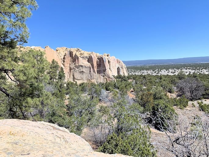
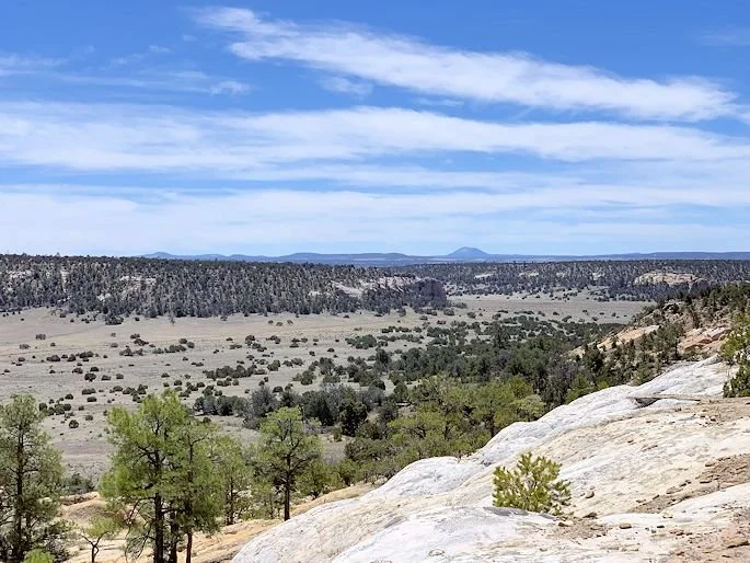
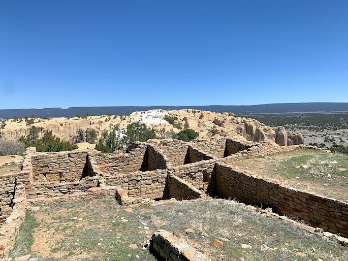
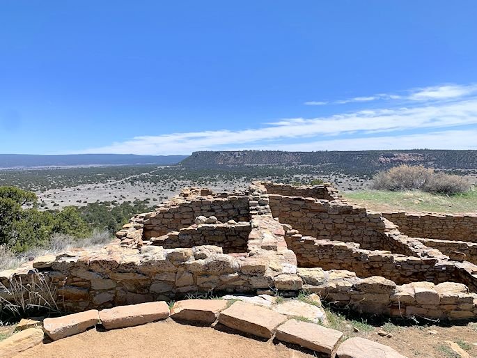
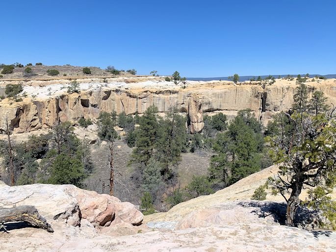
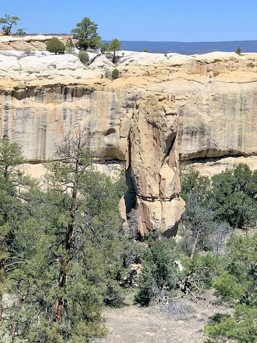
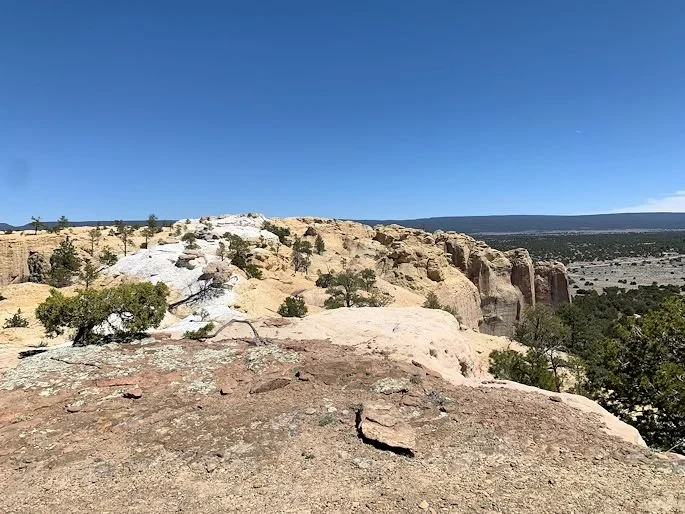
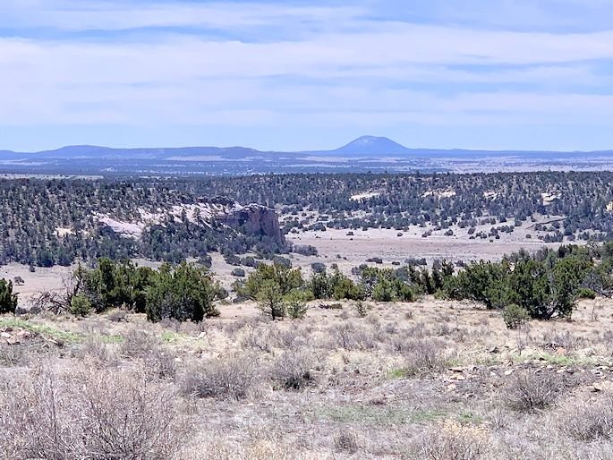
Last week I told you about the wonderful trip that we took out to El Morro National Monument in western New Mexico and how we absolutely loved it. This week, I'm going to detail the part of the trip that took us to the top of the ridge there, thecuesta, which apparently is what a ridge is called that starts gradual on one side and then drops severely on the other. Up on top we found the ruins of Atsinna, which was a Native American village from the 1200s that was peopled by the ancestors of today's Zuni tribe. It was only inhabited for a hundred years or less and then was abandoned. Some theories about how the village got to the top of the cliffs are that heat and drought may have pushed the inhabitants up from the river valleys to the top for additional protection in turbulent times. It didn't hurt that such a big, natural body of drinking water could be found there, too, at the base of the cliffs! These dates in time correspond roughly to the same time that things peaked and then plummeted at Chaco Canyon, only a short 75 miles away to the north. Both were highly advanced societies that traded far and wide with other cultures, had very complex religions and lived in big, multi-story adobe apartment blocks. Whether or not Atsinna was a permanent project that didn't last or a temporary reprieve from the chaos of the lowlands, the views from the top were amazing and we felt that we could literally see to Arizona to the west and Mexico to the south and all the way across New Mexico to the east to Texas! This site was visited in 1540 by Coronado, as he traveled around the Southwest looking for the famed City of Gold, Cibola, that surely was nearby. He was so sure, in fact, that he often killed Native emissaries that wouldn't specifically tell him where all the gold was, convinced that they were hiding the treasure from him. The Spanish period waxed and waned, with the Pueblo Revolt of 1680 clearing the land of Europeans and the year 1692 seeing their return. By the mid 1700s, the Navajo, Apache, Ute and Comanche had effectively retaken the area, making this the most forgotten of corners of New Mexico for the Spanish. With Mexican independence in 1821, the Mexicans really took the fight to the Navajo, waging non-stop war on them, but, again, most of the action was north of El Morro and this area remained quiet. By the 1840s and 1850s, the Americans had reached this point and, sure enough, by the time of the Civil War, a rail line was passing by. It was subsequently dropped for the east-west line over the Continental Divide, but for a short time trains rolled by and saw these amazing cliffs, too.
Another unique story that involves El Morro is that of the United States Army Camel Corps. As soon as we gained possession of the Southwest from Mexico in 1848, the military was already trying to solve the problem of getting horses or mules through such a dry and thirsty land, when they needed to travel from the Rio Grande in New Mexico straight west through Arizona to southern California. The entire route started at the Mississippi River in Arkansas, going all the way to the Pacific Ocean at Los Angeles, with the stretch through New Mexico and Arizona being the most difficult. In 1855, some men were sent to Africa and Europe to study camels in captivity and they were trying to determine if such an animal would work to get the military's men and supplies through the desert. They ended up buying 33 camels in Egypt and Turkey and paid three Arab handlers to return to Texas with them for training. The initial expedition westward in 1856 found that the camels worked excellently and very quickly another 41 were added to the Camel Corps by the following year. They were said to be able to pull loads over the mountains where mules wouldn't, ate cactus and lived well where other animals would surely die. A few years later during the Civil War, the Texas camp where the Camel Corps was based, Camp Verde, fell to the Confederates and that was the end for the US's camels. Most were sold at auctions, but some ended up in circuses and zoos. Some, however, escaped and there were stories of feral camel sighting all the way from Mexico to Arkansas well into the 1900s! Some of the men of this unit carved their names into Inscription Rock here and you can still see the names of Beale and Breckinridge, P Gilmer Breckenridge specifically, at the base of the cliffs. We easily ambled the one side of the little 2-mile loop that goes up to the cliffs, through a very cool cut of stairs in the rocks, but had to turn back because of slides right after the ruins.
So, now for the best part of each week's letter back home, here are some more pictures. I really don't have much to add here, as the first is one of my photo manipulations, but the rest are of the site and views from the top where the site was at. You can see the round structure, most likely a kiva, but there's also what appears to be a square one at the end of the photos. This was an early adaptation of the Puebloans so that maybe, just maybe, the Spanish Catholic Priests would just leave them alone and let them do their prayers underground in peace...clearly the round kivas made them go berserk!
See you soon.

El Morro Ruin

El Morro Ruins I
El Morro Ruins II

El Morro Ruins III
El Morro Ruins IV
El Morro Ruins V

El Morro Ruins VI
El Morro Ruins VII

El Morro Ruins VIII
El Morro Ruins IX
El Morro Ruins X
El Morro Ruins XI
El Morro Ruins XII

El Morro Ruins XIII

El Morro Ruins XIV
El Morro Ruins XV