
Villanueva State Park
December 11, 2022
Howdy folks!
What a weekend we had! After lying around quite a bit to catch up on our reading and a few World Cup matches, we managed to pry ourselves out of our casita by noon on Sunday and headed about 15 miles downriver to Villanueva State Park. We've been through Villanueva(a few miles away) numerous times and absolutely love how it sits on this little saddle of land overlooking the Pecos River. We've always wanted to go to the state park, but still never happened to make it down there as of yet and just took care of that this weekend. It's a tiny, little state park along the Pecos River, where it runs along steep, 4-500' cliffs on the one side and the cutest campground ever on the other. We hiked the Viewpoint Loop Trail and spent roughly two miles walking along the river, climbing up to the top of the cliffs, going even further up to the vista, then making our way back down. Just like where we live in San Jose, this area was not opened up to the Spanish until a treaty was made with the Comanches in 1786, guaranteeing that they wouldn't raid the settlements along the Pecos(which everyone was in constant, dreadful fear of). In turn, this area produced many Comancheros(who traded between the Comanches and the Spanish) and Ciboleros(who went out into the Plains from here to hunt buffalo...cibola). Interestingly, too, the infamous Texan-Santa Fe Expedition of 1841 ended very unceremoniously in Villanueva(then Cuesta), where the remnants of the initial party were induced to give up their arms as they were 'greeted' by the villagers. Texas, then a sovereign nation, thought that it could march a few hundred men across the water-less southern Plains to climb the Pecos and then reach Santa Fe, there seeking out the governor to ask(threaten) about annexation by Texas. The Texans thought that they would be greeted with open arms and instead fell into a cunning trap that the Mexicans laid with nearly 1500 men at hand. After the scouts were initially taken in Villanueva, the soldiers went back downriver to nearby Anton Chico to capture the rest of the expedition. Then, all were rounded up and held in San Miguel del Vado(like 5 miles from our house!), before being taken to Santa Fe and then all the way south to Mexico City, 1500 miles to the south, and finally east to Veracruz, which lies on the Gulf of Mexico. Many of the expedition died along the way, some were executed, but the rest made it back to Texas, via New Orleans, a year or two later. In the end, Texas never took New Mexico, but itself became part of the US, as this area did, too, by 1848. To this day the area retains many of its early Mexican roots.
Here are the pictures from our hike:
1) A shot of the footbridge that we had to cross to get to the trail on the other side.
2) Glancing over our right shoulders, looking up the canyon along the Pecos River.
3) Looking left, downstream, seeing our shadows on the water.
4) A full shot looking upstream, with the sun sparkling on the water.
5) After walking upstream a little, we climb and can look west to see Villanueva.
6) Stone walls used by the Texan-Santa Fe Expedition to corral their horses, with Villanueva in the distance.
7) More stone walls below us and then an ancient threshing floor used by valley residents for their wheat.
8) Looking up the trail as we continue to climb up to the top of the ridge.
9) High enough up now to look to the north and see the tip of Starvation Peak.
10) Now to the northwest we can see Rowe Mesa(that towers over our ranch) and the Santa Fe mountains.
11) The same view to the northwest again, this time up at the vista with a shelter in the foreground.
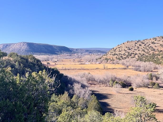
12) A wider view with the floodplain of the Pecos, Villanueva, Rowe Mesa & the Santa Fe mountains.
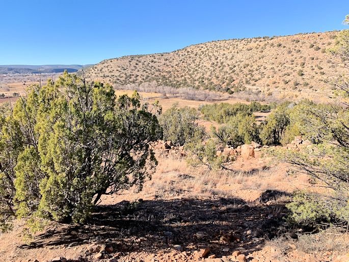
13) Now looking southeast, seeing a little nob further downriver and the Plains beyond in the distance.
14) Starvation Peak from the highest point on the trail, with a sea of juniper & pinyon in between.
15) Looking east from the same point, seeing the last mesa that separates us from the Plains.
16) Again to the northwest, seeing the convergence of Rowe Mesa, the Santa Fe mountains and a closer ridge.
17) A wider angle looking northeast, seeing the canyon that the Pecos River runs through before turning south again.
18) Approaching the edge of the cliff, Villanueva can be seen again in the distance.
19) Erin leading us back down to the river, with Starvation Peak in the distance serving as a fixed point.
20) A view upstream of the river's floodplain, with some of the very rocky cliffs in the foreground.
21) Looking downstream from the top of the cliff, with part of the campground visible below.
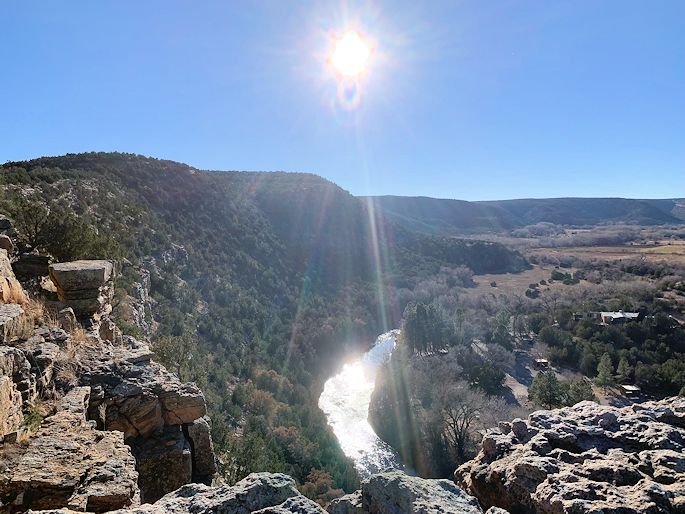
22) Turning around, we see the Southwestern sun lighting up the river and the clifftops.
23) A view to the side of the trail, before we take the plunge back down to the bottom.
24) As we descend, we get a good view of the cliffs that tower over the river further downstream.
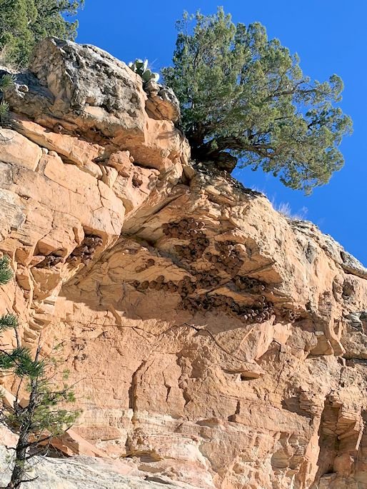
25) Nearly back down to the river, we see swallows' nests in the cliffs everywhere.
26) A little wider shot shows that all of the nests seem to literally cling to the undersides of the rocks that jut out.
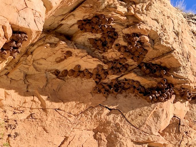
27) Now, a shot of the swallows' nests, as zoomed in as I could get it without losing clarity.
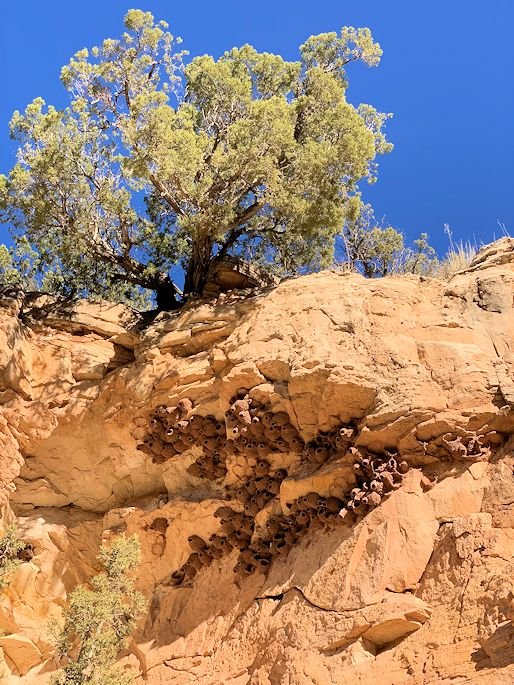
28) One last shot of the nests, showing life both above and below the rocks that reach out towards the river.
29) Finally back to the footbridge, we see the late-day sun lighting up a stretch of rapids in the river upstream.
30) And, lastly, a shot of the downstream edge of the campground, blessed with many, huge cottonwoods.
That's it for this week from beautiful, northern New Mexico!

#1

#2
#3
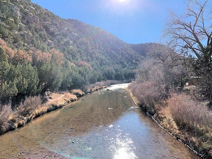
#4
#5

#6
#7

#8

#9

#10

#11

#12

#13

#14

#15

#16

#17

#18
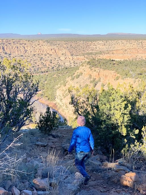
#19

#20

#21
#22

#23

#24

#25
#26
#27
#28

#29

#30